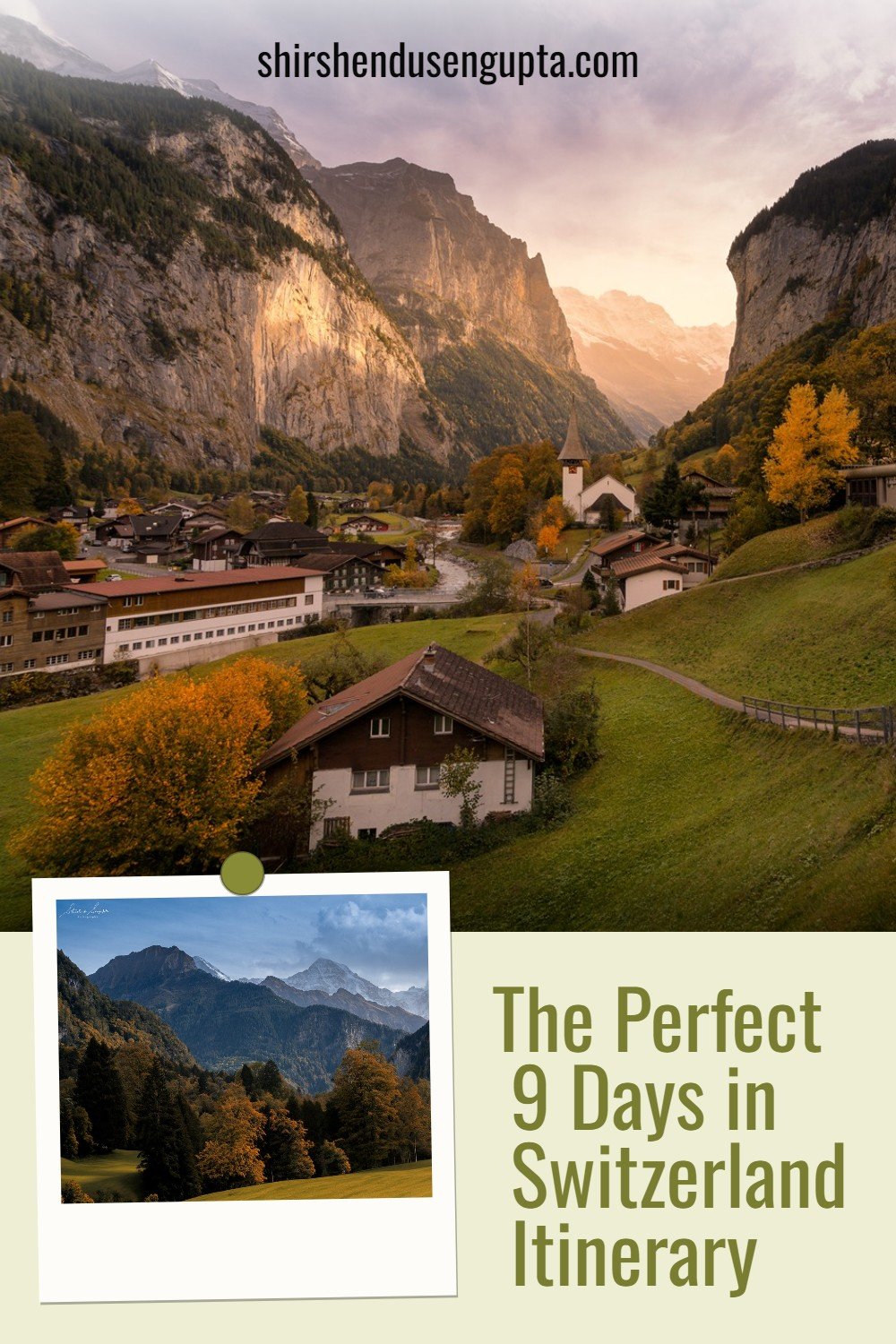
Ultimate 5 Day Iceland Road Trip Itinerary | 37 Best Places to Visit and Things to Do in Iceland | Top 37 Photography Locations in Iceland
Welcome to Iceland - The Land of Fire and Ice!
Uniquely situated on the rift between the North American and Eurasian tectonic plates at the junction of the Atlantic and Arctic Oceans, the island nation of Iceland is aptly dubbed as the ‘Land of Fire and Ice,’ due to the presence of some of Europe’s largest glaciers and most active volcanoes. Iceland is a country with dramatic diversity in climate and geography ranging from volcanoes, lava fields, mountains, glaciers, ice caves, waterfalls, rivers, lakes, hot springs, and black beaches. And due to its vicinity to the North Pole, it’s also an iconic destination to chase the Northern Lights. All of these together, create an enchanting otherworldly ambiance that cannot be expressed in words but has to be experienced in person. And probably that’s the reason why Iceland has been the backdrop of several Hollywood and Bollywood movies and TV Series like Starwars, Tomb Raider, Die Another Day, Batman Begins, Thor: The Dark World, Interstellar, Fast and Furious, Game of Thrones, Vikings, and Katla to name a few!
Shedding some light on Iceland’s history and culture, Iceland was established by a population comprising both Norse and Celtic people during the Viking era of exploration, more than a millennium ago. The early community, which was mainly made up of Norwegian explorers and seamen, made further excursions to Greenland and the North American coast (which the Norse called Vinland). Iceland's closest European neighbor, Scotland, is 800 km (500 miles) away, but despite its physical remoteness, Iceland has always remained deeply ingrained in European culture. Regarded as one of the best literary works of the European Middle Ages, the Icelandic sagas narrate heroic stories honoring the customs and history of the great families who lived in Iceland far from European centers of commerce and culture between 930 AD and 1030 AD.
Iceland had always been on our bucket list, but for some reason or another, we always ended up canceling the trip. But destiny had it in store for us, that after traveling to 44 countries, when we would finally land up in Iceland for spending a long Easter weekend vacation on 27th March 2024, we would be greeted by a freshly erupted volcano (Sundhnúkur in the Reykjanes Peninsula near the town of Grindavik close to the Keflavik Airport that erupted on 16th March 2024) and the Northern Lights, on top of the stunning sights we had already planned for, amidst clear blue sky for all 5 days! So based on our personal experience, today I’m going to share with you the tips and tricks on how to get the most of this amazing piece of creation named Iceland over a period of 5 days. Let the journey begin!
Some Basic Concepts Before We Begin…
What is the difference between Ring Road and Golden Circle in Iceland?
There are two popular terminologies in the tourism industry in Iceland, namely the Ring Road and the Golden Circle that most people get confused with. Let me clear it for you. In simple words, the Ring Road (Highway 1 or Route 1) is the ‘only’ main (two-way) highway in Iceland measuring 1332 km (828 miles) that goes around the entire island like a ring connecting all of the island's major towns, including the capital city Reykjavik. So anywhere you need to go in Iceland you have to get onto the Ring Road, drive until your destination, and then branch from the Ring Road to the interior smaller roads to get to your exact spot.
On the other hand, the Golden Circle is not a road in itself but a small circular tourist route (loop) covering mainly 3 of Southwest Iceland's most popular attractions namely - the Þingvellir (Thingvellir) National Park, the Geysir Geothermal Area, and the Gullfoss Waterfall spanning a drive of 300 km (190 miles) over the same Ring Road. So in other words, the Golden Circle is a much smaller subset of the full Ring Road drive. You can easily drive the Golden Circle in 1 day (which most Golden Circle Tour buses do), whereas you would need at least 10 to 14 days to explore the entire Ring Road.
Which Locations Did We Choose to Travel in 5 Days?
In the 5 days of our stay in Iceland, we decided to visit the 37 most beautiful places in Iceland all of which are located in the Southern part of the country. Among them, the Golden Circle locations constitute only 18.9% (7 locations out of the 37 locations we went to fall under the Golden Circle route). However, in the article below, I’ve highlighted the locations that fall under the Golden Circle, so that if you want to only do the Golden Circle, you can select only those locations in your itinerary.
Did We Do Golden Circle in 1 Day?
Though actually, we could’ve done Golden Circle in 1 day like all tour companies do, we decided to break up the Golden Circle into 2 different days due to the following 2 reasons -
We created streamlined daily routes in different directions from our central base location spanning a much wider area than the Golden Circle. So, we planned to cover the Golden Circle locations that fell on the way of our daily routes instead of having a day dedicated to Golden Circle to avoid redundant driving on other days. The reason being, had we covered all Golden Circle locations in a day, and again the next day if we had to visit another location in the same direction farther than the Golden Circle as per our daily route, we would’ve had to drive on the Ring Road over the same Golden Circle locations again, as the Ring Road is the only highway that connects all locations.
Also, going to all locations in Golden Circle in 1 day would’ve not worked from a photographic standpoint. For photography, you need to plan to visit the spots based on the time of the day when the light is from the right direction. So it could mean that 3 to 4 places will get sunlight in the right spots only in the evening and they are spread wide apart. So you can’t be at all those locations on the same day. So you need to break them apart into multiple days. Now, how we did that is what you will come to know when you finish reading this article.
Which City/Town Did We Choose as Our Base Location?
The most beautiful places to visit in Iceland are all located in the Southern part of the country. Therefore, to explore the south of Iceland people normally stay in 2 locations - Reykjavik, the capital city situated in the south western part of Iceland (from where they explore the south western area), and Vik, the next most popular small town after Reykjavik in the south eastern part of Iceland (from where they explore the south eastern area). But we ditched both and stayed in Selfoss, located at the mid-point between Reykjavik and Vik to make one base location for covering the entire southern region. We booked an individual wooden cottage with a kitchen (they call it a bungalow) which was actually much more affordable compared to accommodations in Reykjavik and Vik.
Our 5-Day Iceland Road Trip Itinerary
In the map below you can see the daily routes denoted in different colors (explained in detail later in the article) from our accommodation in Selfoss followed by the day-by-day planning, explanation, and experience of our travel.
Day 1: Traveling from the Netherlands to Iceland and seeing Sundhnúkur Volcano and the Northern Lights (Light Blue Route on the Map)
Fly-In
A couple of days before Good Friday, we flew to Keflavik Airport Iceland from Amsterdam Schiphol Airport Netherlands in roughly 3 hours. We took an afternoon flight and when we landed in the evening, the local time was 1 hour behind the Netherlands time, since Iceland is in the GMT time zone as compared to the Netherlands which’s in the CET time zone.
Car Pick-Up
We had pre-booked a family SUV Dacia Duster from Blue Car Rentals (more about the reasoning behind choosing this car model and Blue Car Rentals as the car rental company in the ‘Tips and Tricks’ section at the end of the article). Also, we had checked in online for the car pickup to make the pickup zero human contact delivery. So we simply walked 10 minutes outside the Keflavik airport to the Blue Car Rentals pick-up point (there’s also a free airport shuttle service from the airport to the Car Rental companies’ parking lots that runs between 06:00 and 18:00 GMT), entered the safe room, opened our safe with the code provided in the mail after we did online check-in for the car pickup, picked up the keys, followed the instructions to reach the parking lot where the car was parked and then drove away to a nearby restaurant, followed by a supermarket in Keflavik itself to stock our car with necessary supplies for our 5-day trip, and then towards our accommodation in Selfoss.
Sundhnúkur Volcano
Sundhnúkur is a volcano (row of craters) on the Reykjanes peninsula, that erupted in December 2023, February 2024, and March 2024. It is located near the town of Grindavik (close to the Keflavik Airport) and hence often referred to as the Grindavik eruptions. A previous eruption occurred more than 2,500 years ago. At the time of writing this article in April 2024, the area is currently off-limits to the public and cannot be visited until officials deem it safe to do so. Due to the same reason, unfortunately, the much famed ‘Blue Lagoon Geothermal Spa and Resort’ which’s also located in the same area was also closed. So we could not visit it. However, we visited an alternative geothermal spa named the Secret Lagoon. Read on to know more about it.
Just as we left Keflavik for our accommodation in Selfoss, my son Ricky shouted that he could see the Sundhnúkur volcano erupting from the car. So we immediately stopped the car on the emergency lane of the highway with hazard lights like many other cars did to take some pictures. The volcano was visible on the horizon pretty far from us. So, I clicked the image below at 12800 ISO to get a steady handheld shot zooming in 240 mm, under a darkening sky in extremely windy conditions (60 kph wind speed), and performed noise reduction later in post-processing. But still, we got a live volcano shot, and that too on day 1 of arrival. We couldn’t have asked for a better start to our trip than this!
The Northern Lights (Aurora Borealis)
Then we drove 100 km to our cottage in Selfoss in roughly 1.5 hours. When we reached, it was around midnight and since our cottage was located in a secluded place away from light pollution we were greeted by the Northern Lights which we did not expect at all since it was already spring and we were in Southern Iceland (Aurora Borealis is visible in the Northern Hemisphere during winter and most remarkably from Northern Iceland). So I immediately took out my tripod and made some long exposure shots. After taking the Northern Lights shots, we checked into our accommodation and slept off.
Talking about the Northern Lights, the stunning dancing ribbons of light known as the Aurora Borealis, meaning "Lights of the Dawn" derived from the names of "Aurora," the Goddess of the dawn, and "Boreas," the personification of the northern wind, have mesmerized mankind for millennia. Despite its beauty, this amazing light show is actually a violent cosmic event. On the surface of the sun, solar storms release massive clouds of electrically charged particles called corona. Some of these particles eventually arrive on Earth after traveling millions of miles. The Earth's magnetic field, or magnetosphere, which is created by the planet's rotation, deflects the majority of these particles away, but some are caught in it and accelerate towards the north and south poles. The magnetic poles see a concentration of aurora activity because of this. The aurora display is known as the Aurora Borealis near the North Pole and the Aurora Australis near the South Pole. These particles then slam into the atoms and molecules of the gases that make up the Earth's atmosphere at up to 72 million kph (45 million mph), exciting/heating them. Heat causes different gases to release distinct colors. The aurora goes through the same procedure. Nitrogen is responsible for the tints of purple, blue, or pink that we see in the aurora, whereas oxygen is responsible for the green color. Because of the lines of force in the earth's magnetic field, which change and distort as it spins, auroras are known for their unique wavy patterns and "curtains" of light.
Day 2: Exploring Skogar, Vik, and Glacier Lagoon Areas (Dark Blue Route on the Map)
The next morning we woke up in our cottage to a clear blue sky which’s extremely rare in Iceland, especially at this time of the year. So we freshened up and left to explore the Skogar, Vik, and Glacier Lagoon areas. These areas are famous for several Hollywood and Bollywood movies and TV Series shot here. I will tell you more about them as we go along.
Icelandic Horse Farms
GPS Coordinates: 63.54316, -19.67988
We decided to start our day by driving to the Sólheimasandur Plane Wreck spot (coming later in the article). On the way, we caught glimpses of glamorous Icelandic horses with majestic mountainous backdrops. So we decided to stop at some of the horse farms along the way to capture these beautiful creatures in our hearts and the memory card of our camera. I’ve mentioned the GPS coordinates of one of the horse farms that I found with the most dramatic mountainous backdrop but there were several others. This one was opposite the Faxi Bakery in Hvolsvöllur, which is around 90 km (1+ hour of driving) from Selfoss.
Talking about Icelandic horses, they are among the world's purest breeds of horses, descending from an ancient breed of horse that is now extinct outside of Iceland, brought around 1,100 years ago by the first Viking settlers from Norway. The Icelandic horse is most well-known for its human friendliness, robust physique, convenient size, and, of course, its fifth gait (manner of walking of a horse) called tölt where three of the horse's legs make contact with the ground simultaneously, which produces a more steady and even pace thereby helping it to navigate uneven terrain and be sure-footed. Other horse breeds can only execute three or four gaits; the Icelandic horse is the only breed capable of executing five.
Sólheimasandur Plane Wreck
GPS Coordinates (Sólheimasandur Plane Wreck Parking): 63.49093, -19.36341
GPS Coordinates (Sólheimasandur Plane Wreck Location): 63.45969, -19.36489
After our rendezvous with the Icelandic horses, we reached the parking spot of the Sólheimasandur Plane Wreck. With its rusty shell resting on eerie black sands, the Sólheimasandur Plane Wreck is a well-known location in South Iceland. Due to the wreckage's amazing visual contrast with the aircraft's twisted metal and its untamed black surroundings, photographers from both local and foreign communities adore this location. And if you are into science fiction films and have always wanted to be a part of it like me, you ought to be there!
The plane, a Douglas R4D-8 Super DC-3, was once owned by the US Navy and is regarded as a reminder of the heyday of aviation. Iceland, being a NATO member, was home to a permanent US military installation until 2005 and the US Navy frequently flew over Iceland in the 1970s as part of its defense arrangement with the nation. This plane was originally used as a freight aircraft. On Wednesday, November 21, 1973, after delivering supplies for the radar station at Stokksnes, the aircraft was traveling from Hofn Hornafjördur Airport to Naval Air Station Keflavik. However, on the way, the plane crashed into a frozen river near the black sandy plain of Sólheimasandur at around 14:00. There are several hypotheses circulating on the internet about why the jet crashed. Some claim that the plane's construction was damaged by ice, while others assert that the thrusters weren't operating properly. Some claim that the pilot made a mistake and thought the thrusters weren't functioning when in fact they were. Nobody seems to know for sure. I couldn’t find a single article that spoke with evidence. But it doesn’t really matter since the plane did not sink into the river despite the ice breaking during the forced landing and the entire 7-member crew, led by the pilot Captain James Wicke were unharmed and later rescued by helicopter. So at the end of the day, it’s a happy story location where you can take happy pictures of yourselves, and that’s all that matters!
However, today, after 5 decades of enduring intense rain, cold temperatures, strong gales, damage from graffiti, and gunfire, the aircraft's wings are no longer attached, and rumors have it that a nearby farmer made money off the tail a long time ago. So all that remains is the fuselage and engine mounts. But even this is not anticipated to remain there indefinitely. As Sólheimasandur is a glacial outwash plain, it might be washed away by floodwaters in the event of an eruption beneath Mðrdalsjökull glacier.
The crash site of the DC-3 was featured in the music video of Justin Bieber's song “I'll Show You,” on the cover of American musician George Hirsch's album “Hijrah,” Emis Killa's song “Mercurio,” the music video of an orchestral ballad song from the Korean girl group Loona called "Let Me In," in the TV show “Top Gear America,” Netflix sci-fi TV Series “Katla,” and Dutch reality TV game show “Wie is de Mol?” But for me, it was extra special because it was the starting location of a famous Bollywood song “Gerua” from the movie “Dilwale” (if you want to know more about the song, search “Gerua” on Youtube) acted by my favorite Bollywood actor Shahrukh Khan a.k.a. SRK (who was rated as the biggest movie star on the planet by Forbes in terms of net worth and number of fans across the globe). We met him in the Netherlands in 2016 and our meeting was featured as a full-page article in The Telegraph newspaper. But that’s a story for another day!
To reach the crash site, you need to trek on foot for about an hour from the parking. But we wanted to avoid the walk in -10 degrees Celcius as well as wasting 2-3 hours at one spot. So we had pre-booked a shuttle service from https://www.mountainguides.is/tour/plane-wreck-shuttle (but you can also book on the spot) which takes you to and back from the wreck in 10 minutes each side. When we boarded the bus, we saw the bus was full of Indians and the Icelandic driver was telling the passengers his story of meeting SRK during the shoot of the film. He thanked SRK for making the spot famous resulting in additional business. Anyway, upon reaching the crash site after a roller coaster ride over volcanic rocks, every single person in the crowd wanted to do the SRK pose in front of the plane. But who could do it better than me? So when I climbed the wing of the plane and did it, I received a grand applause from the entire crowd. I must say, I had a really supportive audience that day, as always. In SRK’s words, “I’m the best!” Haha, just kidding!
Skogafoss
GPS Coordinates: 63.53232, -19.51088
After that, we drove 10 km (roughly 10 minutes) to Skogafoss. Situated along the Skógá river, Skogafoss is one of the largest and most stunning waterfalls in Iceland, with an amazing width of 25 meters (82 feet) and a plunge of 60 meters (197 feet). This impressive waterfall is easily observable from the Ring Road and is a stone's throw of walk over flat land from the parking. This will make you very wet but it’s totally worth it, especially due to the presence of the rainbow which’s almost always there when the sun is out thanks to the volume of spray the waterfall creates. You can also enjoy a glimpse of Skógafoss from above via a steep stairway that leads to an observation platform above the waterfall.
Skogafoss was featured in the music video of Sólstafir's song "Fjara," Justin Bieber's song “I'll Show You,” Hollywood movies “Thor: The Dark World” and “The Secret Life of Walter Mitty,” the TV Series “Vikings,” and the Dutch reality TV game show “Wie is de Mol?” But for me, it was another shooting location of the “Gerua” song. So I stood no chance and had no choice but to do another SRK pose standing in front of the majestic waterfall adorned with the rainbow while getting fully drenched in -10 degrees Celsius!
Skogar Museum
GPS Coordinates: 63.52638, -19.49311
After visiting Skogafoss, we visited the Skogar Museum just 2 km (5 minutes drive) away from Skogafoss. The Skogar Museum is a cultural heritage collection of 15,000 artifacts exhibited in 3 museums and 6 historical buildings. The Folk Museum displays tools for farming and fishing, boats and nautical equipment, textiles and costumes, musical instruments, rare books and manuscripts, and intriguing natural history. The Open Air Museum exhibits a traditional turf farmstead, a 19th-century gabled farmhouse, a house built from driftwood from a shipwreck, a multi-denominational church made up of sixteen local churches, and a tiny turf home for elves. The Transport and Communications Museums, which house an exceptional collection of cars, trucks, highway equipment, radios, telecommunication devices, and rescue team gear used over the past century, document the technology that converted rural south coast farmsteads into a network of contemporary towns. We spent about an hour mostly walking around the Open Air Museum enjoying the relics and soaking in the Icelandic ambiance.
Víkurkirkja Church (Vík í Mýrdal Church)
GPS Coordinates: 63.41782, -19.00103
From the Skogar Museum, we drove 35 km (30 minutes) to our next destination Vik. Situated roughly midway along the coast of southern Iceland, to the south of the Katla volcano, sits the isolated seashore town of Vik. Vik is the only town for more than 50 kilometers in either direction and hence has grown to be a significant local retail hub and travel industry service! Supplies are few and pricey because of the town's remote location, yet it serves a purpose by connecting Iceland's east and west. Infrastructure includes cafes, supermarkets, gas stations, and swimming pools in addition to a few limited for-profit tourist attractions.
Although Vik has been around since the ninth century, traders didn't establish a regular presence there until 1890, when they came to sell goods — typically flour, salt, and sugar — as well as fruits and vegetables. After a while, Vik had two slaughterhouses and five grocery stores. Over time, the little settlement's population grew and it finally developed into a gathering spot for farmers. When the church was constructed in 1934, Vik's standing as a hamlet and community was cemented. Today, with its whitewashed walls and stunning red-colored roof, the photogenic Víkurkirkja Church is the most visited site in Vik. Situated on a neighboring hill, the church is thought to be the most secure location to flee in the event of an unexpected Katla Volcano eruption or flooding. The church was featured in the Netflix Series “Katla.”
After visiting Vik’s iconic church, we had lunch in the Black Crust Pizzeria opposite to the Vik Church where we saw the vehicle that was used for shooting of the Netflix Series “Katla.” In fact, we came to know for the first time that there is now a guided tour from Vik that takes you around the places where Katla was shot (check out #Katlatrack). We had those places in our itinerary anyway. While we were having lunch the sky turned cloudy and I checked that the forecast of the next day was sunny. So, though we had planned to visit the Dyrhólaey and Reynisfjara black beach regions around Vik on the same day itself, I decided to change the plan since they are not places where you want to be on a cloudy day. So instead we headed to the Jökulsárlón (Glacier Lagoon) 200 km away from Vik (to spend 3 hours of the cloudy time in the car driving and save the sunny time the next day to enjoy the black beaches).
Skaftáreldahraun Lava Field
GPS Coordinates: 63.73150, -18.20581
On the way to Jökulsárlón (Glacier Lagoon), we stopped at the Skaftarendahraun Lava Field driving 75 km (1 hour) from Vik. It looks somewhat greenish due to the growth of moss on the lava. In 1783, one of the largest lava flows in a single eruption in recorded global history known as the "Skaftá Fires" originated from Lakagígar (or Laki) volcano. Molten lava spilled over the lowlands, destroying numerous farms, and filling the gorges that the Skaftá and Hverfisfljót rivers flowed through. It then swept down in two branches into inhabited regions. Its estimated cubic measurement is 16 cu. km, while the lava's square measurement is roughly 580 sq. km.
Though the eruption did not result in any fatalities immediately, the aftermath was dubbed the ‘Mist Hardships.’ A few days after the eruption when the hazardous gases combined with the atmospheric moisture, it formed Sulphuric acid resulting in acid rain that polluted the soil, killed crops, and made the water poisonous. During the Hardships, half of the cattle and one-fifth of the population perished. The situation got so bad that there were even talks of people trying to flee Iceland and settle in Denmark. It is said that the corrosive mist from the eruption was so bad that it extended to areas of North Africa, Russia, and even halfway across the United States. Western Europe was the hardest devastated region outside of Iceland; there are theories that the eruption's air pollution killed many there, including crops. One theory is that the desire of impoverished people starving due to famine following years of crop failure to escape great poverty ultimately led to the French Revolution, a turning point in world history. It's possible that the poisonous mist from this eruption is what caused these crops to perish.
Skaftafellsjökull Glacier
GPS Coordinates: 64.00587, -16.92825
As we continued our journey towards the Jökulsárlón (Glacier Lagoon), we stopped by the highway around 80 km (1 hour drive) from Skaftáreldahraun Lava Field, to witness a stunning sunset with the final rays of sunshine shining on top of the mountains and the Skaftafellsjökull Glacier. The images don’t do justice to what we witnessed with bare eyes. But I tried to capture the moment as best as I could. The GPS location that I’ve shared is the best spot to get the panoramic view of the Skaftafellsjökull Glacier.
Talking about Skaftafellsjökull, it is one of the 30 outlet glaciers (glacier tongues) of Vatnajökull (meaning "Glacier of Lakes" in Icelandic), the largest ice cap in Iceland, and the largest glacier in Europe with an area of 7,900 sq. km, volume of 3000 cu. km, average thickness of 380 m (1,250 ft), maximum thickness of 950 m (3,120 ft), and occupying around 11% of Iceland. Vatnajökull was featured in the James Bond films “A View to a Kill” and “Die Another Day,” the HBO TV Series “Game of Thrones,” the American Reality Competition Show “The Amazing Race 6,” and Westlife's official music video "What About Now."
Jökulsárlón (Glacier Lagoon)
GPS Coordinates: 64.04807, -16.17974
From Skaftafellsjökull Glacier, we reached Jökulsárlón Glacier Lagoon by driving 55 km (40 minutes) post-sunset but that was the best time for the shot I wanted. Jökulsárlón is a lake that receives meltwater from Breiðamerkurjökull, another outlet glacier (glacier tongue) of Vatnajökull, the largest ice cap in Europe. But what makes it unique is that it also fills with icebergs that break off the glacier, some of which are as tall as several stories. Apart from their size, these icebergs are distinguished by their color. The majority of them are mostly white, as would be expected, but they are also partially tinted electric blue with black ash streaks from millennia before. With a depth of 284 meters (932 feet), Jökulsárlón is the deepest lake in the nation despite having a relatively recent formation. At eighteen sq. km (7 sq. miles), its surface area makes it one of the largest as well.
Jökulsárlón and the Breiðamerkurjökull glacier were featured in James Bond films “A View to a Kill” and “Die Another Day,” “Batman Begins,” “Beowulf and Grendel,” “Lara Croft: Tomb Raider” and the “Gerua” song in SRK’s Bollywood movie “Dilwale” where SRK and the lead actress Kajol were dropped by a helicopter on an iceberg where they danced. The lagoon was also the backdrop for the song “Vista” by the Swedish electronic multimedia project “iamamiwhoami,” and French singer Indila's music video "Love Story." The lake gained further popularity when the American TV show “Good Morning America” broadcasted live from Jökulsárlón in southeast Iceland on November 13, 2006, which was watched by 4 million viewers.
Breiðamerkursandur Beach (Diamond Beach)
GPS Coordinates: 64.04428, -16.17433
The icebergs from Jökulsárlón Glacier Lagoon either drift out to sea or wash up on the glacial outwash plain beach of Breiðamerkursandur located on the other side of the highway around 1 km away (10 minutes of walking from Jökulsárlón Glacier Lagoon). This beach has been dubbed "the Diamond Beach" because of the way the icebergs shimmer against the dark volcanic sands of Breiðamerkursandur. We reached there very late, so I didn’t get much time to take iconic shots during sunset. So reach there early in the evening to click gorgeous pictures of the icebergs with the black sand and the sunset. After visiting Diamond Beach, we drove back 320 km (4 hours) in pitch dark to our accommodation in Selfoss and reached around 01:00 GMT. But we knew one thing, that by modulating our plan for Day 2 we used the cloudy time for driving to the most distant location in our entire 5-day trip itinerary (i.e. Jökulsárlón Glacier Lagoon and Diamond Beach) on Day 2 itself. It was a relief, since as the trip progresses you start getting weary of driving long distances and reaching the hotel at late night, so better to cover them as early as possible. So, with these being out of the way, we knew that for the rest of the 3 days, we did not have much driving and we could spend the sunny times out and about!
Day 3: Exploring Golden Circle East Leg and Dyrholaey Peninsula (Red Route on the Map)
The next day we left our cottage in Selfoss early in the morning to explore the East leg of the Golden Circle and the Dyrholaey Peninsula which we actually had in the plan for Day 2 but we had switched it with Jökulsárlón Glacier Lagoon due to unfavorable weather conditions as mentioned above. As promised, I’m going to flag out the Golden Circle locations for some of you who might have the time to do only the Golden Circle.
Kerið Crater Lake - Golden Circle Location
GPS Coordinates: 64.04133, -20.88424
Our first spot for the day was the Kerið Crater Lake which we reached by driving 15 km (15 minutes) from our cottage in Selfoss. I advise you to reach there early in the morning to be able to park your car in the parking lot right next to the crater, else you may have to park at a bigger parking lot a bit further away from the crater and then walk to the crater. We were lucky that a car left as we reached and we got a spot to park at the parking lot close to the crater while other cars were waiting in the queue behind us.
Talking about Kerið Crater Lake, at around six millennia old, it’s still half as old as the majority of Iceland's volcanic calderas. This is the main cause of Kerið's striking red slopes instead of volcanic black as the iron deposits are new. Kerið measures roughly 270 meters (886 feet) in circumference, 170 meters (558 feet) in width, and 55 meters (180 feet) in depth. There is a route that leads directly to the edge of the crater, around it, and down to the clear waters of the crater lake. We did not go down as the water was frozen, but we did the trail circling the entire crater at 60 kph wind amidst -14 degrees Celsius temperature.
Kerið was formerly a volcano with a cone shape, according to scientists. It is generally accepted that the volcano's eruption exhausted its supply of magma, which led to the foundation collapsing in on itself to create the structure that exists today. Water began to fill Kerið Crater at some time in the centuries after the collapse. Depending on the season and amount of precipitation, the resulting lake varies in depth from seven to fourteen meters.
Kerið has cultural significance in the folklore and traditions of Iceland. One legend claims that the lake is bottomless and that underground passageways connect it to other bodies of water. Another well-known folklore linked to Kerið is the one about a treasure buried at the bottom of the lake. The folklore states that a prosperous farmer used to reside near Kerið crater many generations ago. The farmer had a reputation for being wealthy and was said to have accumulated a sizeable fortune. The farmer had a lovely and kind-hearted daughter. The farmer chose to conceal his treasure deep into Kerið crater out of fear that someone would try to steal it. Since the crater was not just far away but also regarded as mystical and maybe guarded by supernatural forces, he thought the place would be secure. The farmer had given his daughter the location of the treasure's secret before he passed away. He did, however, make her promise that she would never tell anyone about it until the family was in dire straits, and till date, it remains unknown.
Skálholtsdómkirkja (Skálholt Cathedral) - Golden Circle Location
GPS Coordinates: 64.12529, -20.52460
After visiting Kerið Crater Lake, we drove 25 km (20 minutes) to Skálholtsdómkirkja or Skálholt Cathedral. Skálholt is one of Iceland’s most historic places. For over 700 years, it served as an episcopal see (the seat of the bishop), a school, a center for administration and education, and a destination for pilgrims during the Middle Ages. The church continues to serve as the Skálholt Bishop's official church. That being said, Skálholt is no longer a diocese unto itself. After being abolished in 1801, the Diocese of Skálholt was reconstituted as a suffragan diocese in 1909. As a result, the bishop is recognized as a suffragan bishop who supports the Icelandic bishop. Nonetheless, the Bishop of Skálholt is in charge of cathedral matters.
Secret Lagoon - Golden Circle Location
GPS Coordinates: 64.13768, -20.30918
From Skálholt Cathedral, we drove 25 km (25 minutes) to Secret Lagoon. This is currently a good alternative for a geothermal spa given that the Blue Lagoon is closed due to the volcanic activity in the Grindavik area. Built in 1891, the Secret Lagoon is the oldest man-made swimming pool in Iceland. It is fed by naturally occurring hot springs at Hverahólmi, a geothermal area close to the southern Icelandic village of Flúðir. The natural setting has been preserved to provide an authentic experience. The pool receives fresh warm water from multiple hot springs, including a small geyser, which keeps the water at a consistent 38 to 40 degrees Celsius all year round. The northern lights are frequently visible in the region throughout the winter. Even though it's not as crowded as the Blue Lagoon, during the summer, reservations are still necessary.
Haukadalur Geothermal Area (The Great Geysir, Strokkur, Blesi, and Litli) - Golden Circle Location
GPS Coordinates (Geysir Parking): 64.30928, -20.30337
GPS Coordinates (Litli Geysir): 64.31184, -20.30118
GPS Coordinates (Strokkur Geysir): 64.31272, -20.30071
GPS Coordinates (Blesi Geysir): 64.31352, -20.30134
GPS Coordinates (The Great Geysir): 64.31381, -20.29949
From the Secret Lagoon, we drove 25 km (25 minutes) to the Haukadalur Geothermal Area. The highlights of the Haukadalur Geothermal Area are ‘The Great Geysir’ or Geyser which used to shoot hot water up to 170 meters (557 feet) but has stopped since 1916 and ‘Strokkur,’ another geyser that erupts every 5 minutes to shoot hot water up to 35 meters (114 feet) to date but unfortunately when we visited the erupted water was swept away by 72 kph wind thereby taking a bit away of the spectacle. Apart from the Great Geysir and Strokkur, ‘Blesi’ Geysir is another prominent hot spring in the Haukadalur Geothermal Area. It may not erupt regularly or according to a set schedule, but it is undoubtedly one of the most beautiful geysers you will ever see in Iceland. The Blesi Geysir is located above the Great Geysir and Strokkur. Blesi consists of 2 pools - a turquoise one with a constant 40-degree Celsius temperature and another with no specific color. Apart from these, you can see thirty little geysers and hot springs in the geothermally active Haukadular valley among which a notable one is the ‘Litli Geysir’ which showcases continuously jumping boiling water.
Talking about geysers, a geyser is a phenomenon of violent eruption of water from underneath the surface of the earth. It's a type of hot spring, but not the kind where you can take a peaceful bath. Instead, geysers are renowned for their powerful outbursts that shoot water skyward. The Great Geysir in the Haukadalur Geothermal Area was the first known geyser to Europeans, some 800 years ago that gave rise to the name of this phenomenon. Because of this, visiting the Haukadalur Geothermal Area is more than just seeing a breathtaking geological display; it’s exploring a significant historical location.
The Great Geysir
Strokkur Geysir
Blesi Geysir
Litli Geysir
Gullfoss - Golden Circle Location
GPS Coordinates: 64.32625, -20.12443
From Haukadalur Geothermal Area, we drove 10 km (10 minutes) to Gullfoss Waterfalls, Iceland’s most famous waterfall located in the canyon of Hvita River. When we reached the wind speed was 80 kph there with a temperature of -15 degrees Celsius and we could hardly stand on our feet but we braved the wind and cold to take some pictures.
Talking about Gullfoss, the Hvítá River receives its water from the Langjökull glacier and then plunges 32 meters (105 feet) over the two stages of Gullfoss in a breathtaking display of the unadulterated power of nature. The first, lesser cascade is 11 meters (36 feet) tall, while the second drop is 21 meters (69 feet) tall. Rising to a height of 70 meters (230 feet), the canyon walls on either side of the waterfall plummet into the massive Gullfossgjúfur canyon. According to geologists, glacial outbreaks at the start of the latest ice age created this canyon. A little over 140 cubic meters (459 cubic feet) of water pour down the waterfall every second during the summer.
Gullfoss was featured in the TV series “Vikings,” the American reality competition “The Amazing Race,” the music video for the single "Heaven" by the band Live, on the cover of the album “Porcupine” by the British band Echo and the Bunnymen, and referenced in the novella “The Odd Saga of the American and a Curious Icelandic Flock.”
Dyrhólaey Lighthouse
GPS Coordinates (Dyrhólaey Lighthouse Top Parking): 63.40437, -19.12922
GPS Coordinates (Dyrhólaey Lighthouse Location): 63.40275, -19.13147
From Gullfoss, we drove 185 km (2.5 hours) to the Dyrhólaey Lighthouse Top Parking in the Dyrhólaey Peninsula which was planned for the day before but we switched with the Jökulsárlón Glacier Lagoon to avoid cloudy weather as I mentioned earlier. Dyrhólaey “Door Hill Island” or the “Arch with the Hole” is a beautiful peninsula along the South Coast of Iceland with its 120-metre tall cliff promenade famed for its staggering views of Iceland’s South Coast.
To reach the Dyrhólaey Lighthouse, you need to walk 3 minutes from the Dyrhólaey Lighthouse Top Parking. The first skeletal steel tower prefabricated in Sweden was established here in 1910. The current lighthouse was constructed in 1927. It marks the southernmost point of the mainland of Iceland.
Dyrhólaey Sea-Arch
GPS Coordinates: 63.40147, -19.12846
From the lighthouse, we walked a couple of minutes to reach the viewpoint from where we could see the Dyrhólaey Sea-Arch, Dyrhólaey’s most instantly recognizable attraction formed by centuries of erosion from which the peninsula gets its name (“Dyrhólaey” means “Arch with the Hole”). In fact, one courageous pilot even flew across this massive and stunning natural structure back in 1993. Boats can pass through its hole with ease. The Dyrhólaey Sea-Arch was featured in the Hollywood movie “Beowulf and Grendel,” and the TV Series “Game of Thrones,” and “Vikings” among others.
Arnardrangur Rock (Eagle Rock)
GPS Coordinates (Dyrhólaey View Parking): 63.40459, -19.10670
GPS Coordinates (Arnardrangur Rock Location): 63.40505, -19.10265
After visiting the Dyrhólaey Sea-Arch, we walked back to the Dyrhólaey Lighthouse Top Parking and drove 2 km (3 minutes) to another parking on the Dyrhólaey Peninsula named Dyrhólaey View Parking. From here, we walked a couple of minutes to reach the viewpoint from where we could see the stunning basalt sea stack Arnardrangur Rock (meaning “Eagle Rock”) which derived its name from eagles that used to nest there, but that hasn't happened since 1850. In the background, you can see the Reynisfjara volcanic black beach and the basalt rock formations in the middle of the sea named Reynisdrangar trolls (more to come on them later in the article).
Reynisfjara Beach
GPS Coordinates: 63.40441, -19.04520
After visiting the Arnardrangur Rock, we walked back to the Dyrhólaey View Parking and drove 20 km (20 minutes) to Reynisfjara Beach, which is a volcanic black beach made out of black sand created from eroded lava. It features Reynisdrangar Cliffs which are basalt rock columns and dramatic rock formations in the sea named Reynisdrangar Trolls.
Reynisfjara Beach was selected as one of the world's ten most beautiful non-tropical beaches. It has been featured in Hollywood movies like “Lara Croft: Tomb Raider,” “Die Another Day,” “Batman Begins,” “Stardust,” “Journey to the Center of the Earth,” “Prometheus,” “Star Trek: Into Darkness,” “Thor: The Dark World,” “Interstellar,” “Noah,” “Star Wars: The Force Awakens,” “Rogue One: A Star Wars Story,” “Fast and Furious 8,” Bollywood movie song “Gerua” from SRK’s movie “Dilwale,” TV Series “Katla,” “Game of Thrones,” “Vikings,” “Black Mirror,” and “Eurovision 2020” song contest, among many others.
I got so engrossed in taking pictures of the violent white waves crashing contrasting black basalt rock columns during high tide that a sudden wave gained a gigantic size and crashed on me to wet my shoes and almost sweep me away. And those who know my focus and stubbornness towards my goal, after my feet got wet I got more determined to get the shot I wanted, come what may and I finally got it though at the cost of drenching my feet and moreover my favorite shoe!
On our way back to the car parking, I came across signs (that we hadn’t seen before) that cautioned against the potential danger of “Sneaker Waves,” and requested visitors to maintain at least 30 m (100 feet) from the shoreline and avoid turning back towards the waves. “Sneaker Waves” (also called “Sleeper,” “King,” or “Rouge” waves) are large coastal waves up to several meters tall (Reynisfjara Beach is apparently infamous for many fatalities due to it) that can erupt out of nowhere amid a train of smaller waves. Just before they reach the coast, these waves have the ability to climb quickly. And owing to the ocean floor progressively deepening away from the coast, people cannot estimate the size of the waves as they look smaller/lower. If such a sneaker wave knocks you off your feet, it can be very difficult to get back up and regain your balance. This is due, in part, to the wave's ability to generate suction, which draws you out and removes gravel and sand from under your feet. Nothing can be done to save you once you are in the ocean since the currents will carry you away from the coast. In a matter of minutes, you become hypothermic due to the freezing water. So, after reading it I considered myself lucky. However, I still had to stay in -15 degrees Celsius and chilly wind with freezing wet feet for another 3 hours before I could reach our accommodation back in Selfoss.
Reynisdrangar Sea Cliffs (Basalt Rock Columns)
GPS Coordinates: 63.40318, -19.04234
The spiky basalt columns on the Reynisfjara Beach named Reynisdrangar (meaning “The Lava Rocks” in Icelandic) towering 66 meters (217 ft) into the air were once part of an active volcano called Reynisfjall which erupted around 900 years ago. They were formed by fast-flowing lava from Reynisfjall. As the lava cooled these remarkable columnar towers were created by a mechanism called ‘Columnar Jointing.’
Hálsanefshellir Cave
GPS Coordinates: 63.402785, -19.04143
Hálsanefshellir Cave is not really a deep cave, but a nook in a gigantic basalt wall, situated on the Reynisfjara beach. The hexagonal basalt pillars near the cave's entrance are what make it unique. It’s only reachable during low tide.
Reynisdrangar Trolls (Basalt Sea Stacks)
GPS Coordinates: 63.39931, -19.03121
At the Reinisfjara beach, another set of prominent rock formations that can be seen is the Reynisdrangar Sea Stacks commonly called Reynisdrangar Trolls. As per Icelandic folklore, trolls are giants. They reside among mountains, cliffs, and rocks. They only venture outside of their home when it is completely dark. They are killed by sunshine and they turn into stones. Trolls are considered the black sheep of the mythical monster family, in contrast to the highly intelligent and fiercely territorial Icelandic elves. They can perform magic and cast spells, but because they are thought to be idiotic, they frequently make mistakes as a result of their stupidity!
There are several legends about the Reynisdrangar trolls from which it derives its name -
According to folklore, two trolls once tried in vain to pull a three-mast ship from the sea to the land. The trolls were engrossed in their game to the extent that they were unaware of the approaching sunrise. As the sun rose, the trolls were frozen to stone and were destined to stand on the beach until the end of time.
Another legend tells of a husband discovering his wife frozen at night after being abducted by the two trolls. The husband forced the two trolls to make a vow that they would never kill anyone again. The free spirit of his wife, the love of his life, remained in Reynisfjara forever among the sea, rocks, and trolls. An alternate version of the same story describes that the husband tracked the trolls all the way to Reynisfjara beach and made sure they would never kill again by freezing them.
The third local folk tale asserts that they are, in fact, trolls. However, upon closer inspection, it turns out that the trolls in Reynisfjara and the ones in the Faroe Islands (an autonomous territory under the Kingdom of Denmark located between Iceland and the UK) were attempting to draw each other together, but they were turned into stone. As a result, you can discover the same formations on a beach there as well.
However, despite these legends, some people believe that these columns of basalt were formerly a part of the vast coastal cliffs that stood intact while the ocean wore down other sections. Regardless of the narrative you choose to believe, you cannot deny that they are a delight to behold!
Reyniskirkja Church
GPS Coordinates: 63.41898, -19.04785
After visiting the Reynisfjara Beach, we drove for a couple of minutes (2 km) to the Reyniskirkja Church which is a typical Icelandic church in a serene setting with a small cemetery. Though it is located 10 km away from the strikingly similar looking Víkurkirkja Church (Vik Church) that I mentioned above already, you must not confuse between the two that most do. In fact on most websites and even on Tripadvisor, on Reyniskirkja Church’s page, they have images of Víkurkirkja Church (Vik Church). On the way to the church, we saw stunning landscapes with typical Icelandic houses.
Seljalandsfoss
GPS Coordinates: 63.61576, -19.99378
From the Reyniskirkja Church, we dove 60 km (45 minutes) on the way back to our cottage in Selfoss to reach the Seljalandsfoss waterfalls. We had planned to visit it on the way back to our cottage since we knew that in the morning the sun is behind the waterfall and during sunset, the sunlight lands on the waterfall. The well-known Eyjafjallajokull volcano, which is topped by glaciers, provides water for the Seljalandsfoss waterfall. This strong waterfall empties into a charming meadow. Seljalandsfoss is one of the rarest waterfalls in the world where you can walk behind the falls and see the water falling from over your head. Unfortunately during spring due to icy conditions, the trail to go behind the falls was closed. Also, it would have made us fully wet and that was not a good idea at -15 degrees Celcius.
Seljalandsfoss was featured in the movie “CKY2K,” “The Juniper Tree,” the American Reality Show “The Amazing Race 6,” the music video of Justin Bieber's song “I'll Show You,” and “Star Trek: Discovery.” Among Indian audiences was made famous by the sunset scene in the “Gerua” song from SRK’s Bollywood movie “Dilwale” where SRK and the lead actress Kajol dance behind the waterfall with the sun setting over the horizon. After visiting Seljalandsfoss, we drove back 70 km (1 hour) to our accommodation in Selfoss.
Day 4: Exploring Golden Circle West Leg and Reykjavik (Green Route on the Map)
The next morning we woke up to the sound of violent stormy wind blowing across the windows of our cottage. I immediately checked the Icelandic Meteorological Office website and saw that they have issued a yellow warning for winds up to the speed of 108 kph across the south western and south eastern parts of Iceland (colored in light to dark violet in their wind forecast map) and advised tourists to change their travel plans accordingly, since it was too dangerous to drive on uneven mountainous roads with risk of car toppling (especially bigger/higher vehicles that have more surface area for wind to act upon), rocks or volcanic debris flying, or trees falling.
Looking deeper into the wind forecast map I found that the capital region of Reykjavik and the Þingvellir (Thingvellir) National Park area (west leg of Golden Circle) close to that was colored in light to bottle green meaning up to 70 kph wind but safe to travel. So we dropped the plan of driving 3 hours to the west to visit the Kirkjufellfoss (the Arrowhead Mountain with waterfalls on the side as featured in “Game of Thrones”) which anyway was a big detour from our Southern Iceland itinerary and would have meant an 8 hour of time loss by driving on a sunny day. So actually God helped us streamline our plan by getting rid of the detour. So then finally, we set out to explore the west leg of Golden Circle and Reykjavik.
Hrafnagja - Golden Circle Location
GPS Coordinates: 64.25831, -21.02359
We started the day by driving 40 km (45 minutes) to the Hrafnagja Observation Deck in Þingvellir (Thingvellir) National Park. Hrafnagja is a 7.7-meter-long canyon, with a width of 68 meters at its widest point. It denotes the western edge of the Eurasian tectonic plate.
Öxararfoss - Golden Circle Location
GPS Coordinates: 64.26565, -21.11712
From Hrafnagja Observation Deck, we drove another 8 km (10 minutes) to the mighty Öxararfoss waterfall which is one of the most well-known attractions of the Þingvellir (Thingvellir) National Park, which in turn is one of the most well-known attractions in all of Iceland. The waterfall emerges from the Öxará River and cascades in two drops over the Almannagjá Gorge that symbolizes the eastern boundary between the Eurasian and North American tectonic plates. The waterfall is 13 meters (44 feet) high and 6 meters (20 feet) wide on average. Large, polished boulders, which become especially icey in the winter, are scattered around the pool of water at the base of the waterfall. You may visit the waterfall all year round, but during the summer, when it's at its busiest, be prepared for big crowds. In our opinion, it is one of the most photogenic waterfalls in Iceland. Öxararfoss waterfall was featured on the cover of Nine Inch Nails's album “The Fragile.”
Þórufoss (Thorufoss)
GPS Coordinates: 64.26344, -21.37051
From Öxararfoss, we drove 25 km (25 minutes) to Þórufoss (Thorufoss) on our way to Reykjavik. Þórufoss (Thorufoss), located in the east of Lake Thingvallavatn, is the largest of the numerous rapids and cascades that flow northward into Hvalfjörður Fjord, having its source in the 25 km Laxá í Kjós River. This picturesque waterfall, which is a little diversion from the Ring Road, is situated 62 feet below a circular rock and spans over 100 feet in width. On the way to Þórufoss (Thorufoss), we suddenly saw a tiny yellow cottage in the middle of a horizon-spanning vast expanse of snow. And as soon as I saw it, I knew I had to stop the car there!
Reykjavik
From Þórufoss (Thorufoss), we drove 40 km (40 minutes) to Reykjavik where we spent the rest of the day, and drove back 60 km (1 hour) to our cottage in Selfoss in the night after our Reykjavik city exploration.
Situated near Faxaflói Bay in southwest Iceland, Reykjavík is the capital of Iceland and the northernmost capital of any sovereign state globally. Glaciers, earthquakes, and volcanic eruptions have sculpted the landscape of the city over the millennia, as the area is geothermal; after all the name translates to "Smoky Bay." Though it only has 120,000 residents, it's a thriving city that welcomes a growing number of tourists each year. It is the political, cultural, and economic hub of Iceland and is regarded as one of the world's safest and cleanest cities.
Reykjavík is a city of striking contrasts: it is both polished and dynamic, small-town and international, youthful at heart and yet rich in history. There are numerous landmarks worth seeing, both old and contemporary, such as the Hallgrimskirkja Church, Sun Voyager, and the recently constructed Harpa, an oceanfront music and conference facility. Reykjavík has everything you might possibly need nearby, including theaters, museums, galleries, cafés, and swimming pools. Therefore, it's probably best to explore the city on foot or by bicycle.
Reykjavík was supposedly founded in 874 by the Norseman Ingólfur Arnarson. It was a tiny fishing community and trading station up until the 20th century. On August 18, 1786, it was given municipal rights and became the administrative hub of the Danish-ruled island. As the seat of the Althingi (parliament) since 1843, it became the capital of a self-governing Iceland under the Danish king in 1918 and that of the independent Republic of Iceland in 1944.
A separate article on the best places to visit in Reykjavik is coming on my blog soon. So stay tuned!
Day 5: Exploring Reykjanes Peninsula and Traveling back to the Netherlands (Purple Route on the Map)
The next day, we had the flight back to the Netherlands late in the evening from the Keflavik Airport in the Reykjanes Peninsula. So we had decided to set aside the last day of our trip to explore the Reykjanes Peninsula, then drive back to the airport, drop off the car, and then fly back to the Netherlands. Just to remind you again, Reykjanes is the peninsula where the recent eruption in the Sundhnúkur Volcano has taken place near Grindavik and hence the famous geothermal spa Blue Lagoon is also closed right now. The entire area is very geothermally active and hence there are lava fields, igneous rocks, and hot springs across the peninsula.
Kleifarvatn Lake
GPS Coordinates: 63.92558, -21.99625
So we started the day by checking out from our bungalow, putting all the luggage in the booty of our car, and shooting off 75 km (in 1 hour) to the Kleifarvatn Lake, the largest lake of the Reykjanes Peninsula covering an area of 9.1 sq. km (3.5 square miles). At 97 meters (318 feet) deep, it is also one of Iceland's deepest lakes. Kleifarvatn is in the middle of the Reykjanes Peninsula, close to the geothermal sites of Krýsuvík and Gunnhver. The Reykjanes Peninsula and Kleifarvatn are located between the North American and Eurasian tectonic plates, on the Mid-Atlantic ridge's fissure zone. This area is well known for its geothermal and geological activity; hot springs can be found steaming in numerous places, and a thick covering of lava covers the entire terrain, with a menacing layer of moss on top. There are no rivers that feed Kleifarvatn; instead, all of the water entering and leaving the area comes from the lava rock's porous surface. Despite this, there is still a lot of fish in the lake, and fishermen like fishing there.
The reason for the frequent earthquakes and eruptions in this area is due to the movements of the tectonic plates. In 2000, an earthquake hit Kleifarvatn depleting more than twenty percent of its surface area, and forming hot springs in one area of the lake. The draining of Kleifarvatn inspired the Icelandic writer Arnaldur Indriðason to write a novel named “Kleifarvatn” after the lake. It is a crime fiction wherein, after the receding waters reveal a body that has been hidden beneath the surface for a long time, the story follows how the lady was killed.
Seltún Geothermal Area
GPS Coordinates: 63.89588, -22.05421
From the Kleifarvatn Lake, we drove 5 km (5 minutes) to the Seltún Hot Springs. Seltún Hot Springs is a geothermal hot spring system located in the Reykjanes peninsula's Krýsuvík volcanic area. There are fumaroles, solfataras, warm springs, bubbling mud pools, and hot springs in the geothermal area. The springs sport a distinctive yellow-orange hue due to their elevated sulphur concentration. This site was used for sulphur mining up to the 1880s. The hot spring water emerges from deep fissures and vents in the crustal zone, having been heated by subterranean geothermal sources. Superheated steam emerges from a subterranean reservoir that is boiling. It finally combines with surface water after condensing and combining with groundwater. At temperatures greater than 50 degrees Celsius, the hot spring water is released from the source. The warm springs have temperatures between 34 and 50 degrees Celsius. Over the region, a boardwalk with observation platforms has been built which is a fairly small trail and I urge all of you to must do.
Midlina (Bridge between Continents)
GPS Coordinates: 63.86841, -22.67549
From Seltún Geothermal Area we drove 70 km (1 hour) to the Midlina (Bridge between Continents). Walking from Europe to North America in a matter of seconds may seem impossible, but Iceland is a special country where seemingly impossible things can actually happen. Reykjanes Peninsula sits directly on the Mid-Atlantic Ridge between the North American and Eurasian tectonic plates. The forces of Earth cause these major tectonic plates to migrate apart by a few centimeters every year. The 15-meter (50-foot) Bridge between Continents, also known as Midlina, spans a wide rift between the North American and Eurasian tectonic plates in the Reykjanes Peninsula. Nowhere else in the world, you can see these continental plates on the ground (as all of them are under the oceans) but in here. Hence UNESCO has designated Reykjanes as an international Geopark.
When you approach the bridge, you can find the words "Welcome to North America" and "Welcome to Europe" written on both sides. Halfway down the footbridge, you can find a plaque that says "Miðlína, In the footsteps of the Gods." This marks the separation of the North American and Eurasian plates. After crossing the bridge you can get a personalized certificate from the Reykjanes Information Center. It confirms that you really traveled the entire distance by foot from Europe to America (or between the two tectonic plates, at the very least).
Previously, the bridge was known as "Leif the Lucky" bridge, after the well-known Icelandic explorer Leif Ericson, who as per the Icelandic Sagas, is credited with being the first Icelander to set foot in North America more than a millennium ago. Additionally, the bridge represents the connection between the two continents — Europe and North America, the old and the new world!
View from Midlina (Bridge between Continents)
Gunnuhver Hot Springs
GPS Coordinates: 63.82048, -22.68459
From Midlina we drove 7 km (10 minutes) to Gunnuhver Hot Springs, the largest hot spring and mud pool in Iceland. The entire region, which is near the Reykjanes lighthouse, is referred to as Gunnuhver. This is one of Iceland's most active geothermal zones, complete with mud pools and steam vents, situated near the southernmost point of the Reykjanes Peninsula. You can see the largest mud pool in Iceland, the Gunnuhver Hot Springs measuring 20 meters (65 feet) in width and boiling violently, if you have the nerve to stroll past the wooden boards that cross the region. When steam from the geothermal pool condenses and combines with the surface water, a mud pool is created. However, the water becomes acidic due to gases like carbon dioxide and hydrogen sulphide. When we were there, due to the extremely windy conditions, the entire wooden board was swarmed with the gases and smoke from the mud pool and we were not advised to walk over it. But we could feel the boiling vents beneath our feet. That was quite an eerie feeling in itself.
Like all things in Iceland, Gunnuhver has a backstory. The eerie tale began almost 400 years ago. A lawyer by the name of Vilhjalmur Jonsson had a tiny house where a woman by the name of "Gunna" used to live. The woman's mystery pot, which she always had something cooking in, raised suspicions that she was a witch. One day, when she was unable to make the rent payments, Vilhjalmur took away her cooking pot. Gunna became so furious that she starved herself to death. Vilhjalmur Jonsson was there for her funeral, but as they were escorting her to the grave, the men heard a menacing voice, "No need deep dig, no plans long to lie." Vilhjalmur was discovered dead the very following day, his body covered in bruises and his bones fractured. And it was thought that Gunna took her revenge. After that, she started threatening the locals on the peninsula. Frustrated, the villagers asked a priest for assistance in setting up a trap for her, which finally made her fall into the hot spring. The hot spring has been referred to as Gunnuhver or Gunn's hot spring ever since.
Brimketill Lava Rock Pool
GPS Coordinates: 63.82004, -22.60581
From Gunnuhver Hot Springs we drove 5 km (10 minutes) to the Brimketill Lava Rock Pool. Brimketill is a famous coastal rock pool in the Reykjanes Peninsula naturally curved through marine erosion and known for its seasonal variations in beauty and local mythology. Its current name “Brimketill” translates to “Whitewater Cauldron,” albeit this was not its original name. In the past, it was called “Oddnýjarlaug,” which translates to "Oddný's Pool," after a troll or giantess. The water was avoided at night when Oddný was active because tradition has it that she used it to bathe and wash her garments there (Icelandic lore states that sunlight turns trolls into stone, so they come out only at night).
Reykjanesviti Lighthouse
GPS Coordinates: 63.81397, -22.70932
From the Brimketill Lava Rock Pool, we drove 8.5 km (in 15 minutes) to Reykjanesviti Lighthouse, the oldest lighthouse in Iceland situated at the tip of the Reykjanes Peninsula. In 1878, the first lighthouse in Iceland was constructed on Valahnúkur in Reykjanes. By 1905, Valahnúkur had sustained so much damage from earthquakes and surf that there was a chance the lighthouse might topple into the ocean. Thus, atop Reykjanes' Baejarfell hill, a new lighthouse was constructed between 1907 and 1908, and the previous one was demolished by an explosion on April 16, 1908. According to a 2007 study overseen by Rögnvaldur Guðmundsson for the Icelandic Maritime Administration, the Reykjanesviti Lighthouse is the most popular lighthouse in Iceland. Reykjanesviti Lighthouse was featured in the Hollywood movie “Flags of Our Fathers” by Clint Eastwood.
Reykjanesta (a.k.a Valahnúkamöl)
GPS Coordinates: 63.81246, -22.71858
Continuing our drive from the lighthouse towards the ocean for a few hundred meters we ended up at the beach which’s the tip of the Reykjanes Peninsula known as Reykjanesta (a.k.a Valahnúkamöl) where we saw stunning rock formations. Reykjanesta was featured in the Hollywood comedy spoof film based on Eurovision named “Eurovision Song Contest: Story of the Fire Saga” and “Prince of Darkness (Myrkrahöfðinginn)” by the Icelandic director Hrafn Gunnlaugsson.
Volcano Man Keyboards
GPS Coordinates: 63.81264, -22.71612
On the Reykjanesta you can find the keyboards that were used for the shoot of the song called “Volcano Man” sung by Will Ferrel and Molly Sanden in the hilarious Volcano Man costume in the comedy spoof film based on Eurovision named “Eurovision Song Contest: Story of the Fire Saga.” If you haven’t watched it yet, you must. It’s a great entertainer!
Car Drop-Off and Fly-Out
After visiting Reykjanesta, we drove 35 km (35 minutes) to the Blue Car Rentals drop-off point, dropped off the car, took the airport shuttle from Blue Car Rentals drop-off office to the Keflavik Airport, and flew back to the Netherlands.
Info, Tips, and Tricks
Choose the right season for visiting Iceland
Iceland appears charismatic across all seasons. Although your travel itinerary will influence when you want to visit Iceland, summer is usually the best season to go. You can see the lush landscape, do animal spotting, go hiking, or do other summer activities at relatively higher temperatures and extended daylight hours, known as the midnight sun. For viewing the Northern Lights, September through March is the ideal time to visit Iceland. The country's well-known geothermal baths are best seen in the winter when they're likely to be less crowded. And if you're arranging a trip to see anything special, like the whale or puffin migrations, you must travel during a specified time of year. However, if you want the best of both worlds of summer and winter i.e. you want to see the real ‘Fire and Ice’ together and that too at a relatively low cost, go during spring as we went.
Choose the right base for exploring Iceland
Like I said at the beginning of the article, the most beautiful places to visit in Iceland are all located in the southern part of the country. So, if you love driving, then you should choose a central location between Reykjavik and Vik instead of staying at both of them. I recommend staying at Selfoss or Hella as they are strategically located and offer accommodation at much more reasonable prices than Reykjavik or Vik.
Plan for your health
In Iceland, you will get sulphur smell from the tap water, especially the hot water during the shower. The reason is that the hot water is directly supplied from the geysers after treatment for harmful elements. But don’t worry. Both I and my wife are allergic to sulphur, but we did not have any problems. Just be careful to wear masks or cover your nose when you are in geothermal areas, especially near clouds of smoke. But as you can imagine from our photos, we covered almost all major geothermal areas and had no problems whatsoever.
Plan your budget
Iceland is expensive since they have to import almost everything. So do not expect supermarkets to be pocket-friendly either. Also, everyone here drinks tap water, so still mineral water bottles are less available in smaller supermarkets (you may find them in big supermarkets but in local stores you get mostly carbonated water) and are very expensive. But if you are allergic to sulphur like us, you may not want to take chances drinking the tap water and hence have to end up spending hundreds of Euros on mineral water bottles. So now that you know this, plan your budget upfront to avoid surprises when you are there.
Plan for the check-in/out timings of your accommodation and international time zones
In Iceland all hotels/accommodations do not have 24-hour reception, and all have different check-in and out timings (for most of the accommodations across Iceland, check-in starts only after 14:00). So, you need to know it before booking the hotel, and let them know your arrival time by calling them on the day of travel when you start traveling from your home country. Also, please account for time changes when you cross the international time zones.
Pre-book the right car model from the right rental car company with the right insurance package
As I always advise my fellow travelers, never ever blindly choose a car rental company when traveling to a new country based on your experience in the same car rental company in another country. So always research online and see what is the best local car rental company in terms of prices, insurance, and convenience instead of straightaway choosing an international company like Hertz or Avis. Also, choose the model of the car that’s best suited for the terrain and your requirements (if you need a small car, or a station wagon, or an SUV). Also, pre-book the car ahead of time to avoid nasty surprises when you reach.
We had pre-booked a family SUV Dacia Duster from Blue Car Rentals. Iceland roads are dicy with hazards of sand, volcanic rocks, and ash, and hence Dacia Duster is a very popular model here among tourists to drive under these conditions and Blue Rentals is the number 1 rental company in Iceland. We opted for the full liability waiver insurance package which includes super collision damage waiver (SCDW), Gravel Protection (GP), Theft Protection (TP), and Roadside Assistance Waiver (RAW) and costed around 500 Euros for 5 days. I always recommend taking the full package as taking any other plan may lead to some critical things missing in your insurance contract which may lead you to buy additional packages later to cover them (hidden costs). And if you do not cover yourself against those critical things, later the car rental companies may try to squeeze money out of you by showing minute damages like scratches calling them not covered under the insurance (which may have already been there before you picked up the car). So taking the full package always gives you peace of mind while you are on a family vacation.
Finally, I always recommend checking in online for the car pickup like we did (if your car rental company has the service), to make the pickup zero human contact delivery.
Plan for fueling
Before you travel every day, plan your fuel stops on your daily route since there are limited fuel stations along the Ring Road.
Plan for driving within speed limits
Remember in Iceland, the speed limits are as given below. So please plan to abide by them to avoid hefty fines.
On paved roads like the Ring Road - 90 kph
On gravel roads - 80 kph
In cities - 30 to 50 kph
In national parks like the Þingvellir (Thingvellir) National Park - 50 kph
Plan to cook and carry food
A trip to Iceland for a week may be expensive as well as if you are on a day trip to a remote location like the Reykjanes Peninsula, for instance, there are limited eateries on the way. So I recommend renting accommodation with a kitchen and cooking lunch in the morning and carrying with you in lunch boxes or cooking dinner in the night upon return.
Pay in ISK
Iceland is not in the EU and hence the local currency there is Icelandic Króna. Try to use your bank card but pay in ISK rather than Euros when the POS terminal asks for it. You will get better exchange rates.
Plan for the weather
If you are planning to drive across vast distances in Iceland, know that it has a very varied climate. The Western fjords, Northern, Eastern, and Southern parts of Iceland may have different weather conditions on the same day. So always research on the day of travel, and modulate your itinerary accordingly as we did. Also, pack appropriate dresses according to the weather.
Plan for parking
In most places in Iceland, you can just pull over to take pictures. But in major tourist sites, you need to pay to park. So either you can choose to get the tickets from the ticket machines or use the ‘Parka’ app on your phone to conveniently pay for your parking online.
Reach out to the locals if you have any trouble
Icelandic people are fluent in English and extremely helpful. So, if you are unable to understand what’s written in Icelandic on a product package you are trying to buy from the supermarket, or you cannot find the way or your car simply has a problem, feel free to reach out to the locals. They will go out of their way to help you!
Epilogue
So that brings us to the end of our 5-day road trip itinerary across Iceland. Please let us know in the comments below if you enjoyed reading this article. And until we meet next time, I wish you merry traveling and happy shooting!
Pin the article
Bookmark the article for reading later!

Want to license/buy photos in the article?
License photos for commercial/editorial use or buy photo prints!
Want us to write an article for you?
Articles for magazines, newspapers, and websites!
Watch our Videos
Check out our videos on our Youtube Channel!
Join the Newsletter
Get updates on our latest articles!
We respect your privacy. Read our policy here.